On one of his days here we took the Cog Railroad to the top of Mt. Washington
This is Mt. Washington as seen from our front lawn

Set 2 of My
Favorite Hiking Trails in the White Mountains
Cannon Mountain Rim Trail, Flume Gorge, Bridal Falls, Lost River Gorge and
Caves, and the Livermore, NH Ghost Town
Bob Jensen at
Trinity University
Son Marshall visited in July 2012
On one of his days here we took the Cog Railroad to the top of Mt. Washington
This is Mt. Washington as seen from our front lawn
The Appalachian Trail passes over the summit of Mt. Washington
Hiking up there is not recommended in the winter when the winds average over 75
mph each day at well below zero

This is the unbelievable
Cog Railroad
that operates one steam engine and several biodiesel engines
It takes over a ton of coal to chug the old steam engine to the top of the
mountain
Mt. Washington Cog Railway ---
http://en.wikipedia.org/wiki/Mount_Washington_Cog_Railway
Later this summer I will have a special edition of my photographs devoted to our
trip up to the top of the mountain
The top of the mountain is the only point on the Appalachian Trail that's both
above timberline and on permafrost


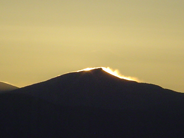
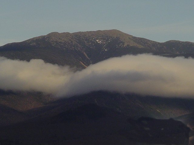
The is sunrise picture was taken of Mt. Garfield (south of Mt. Washington) from my desk at Sunrise
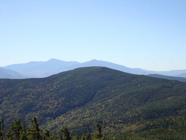
Mt. Washington is part of the Presidential Range of Mountains visible from our
cottage
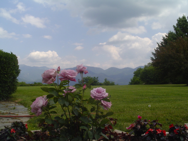
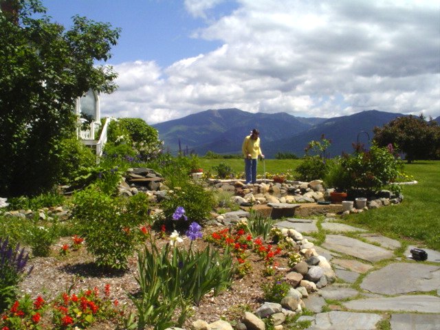
The closest range visible from our cottage is the Kinsman range as viewed from
Erika's rose garden
 \
\
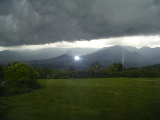
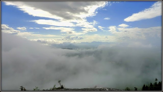
An ominous storm cloud hanging over our cottage
Straight across
is the cloud-covered Franconia Notch between Mt. Lafayette and Cannon Mountain
This is a zoomed picture while I was standing in our front yard
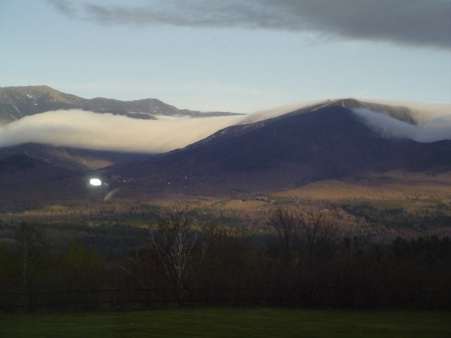
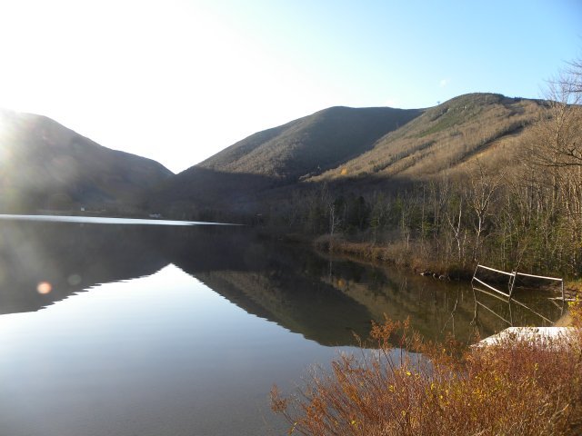
Franconia Notch
is in a New Hampshire State Park with many walking trails
For a nice short
walk take the trail around Echo Lake at the base of Cannon Mountain
The most famous lengthy hiking trails in Northern New England:
Northern Part of the Appalachian Trail ---
http://en.wikipedia.org/wiki/Appalachian_Trail
Portion of the Appalachian Trail in New Hampshire --- http://en.wikipedia.org/wiki/Appalachian_Trail_by_state#New_HampshireNew Hampshire has 161 miles (259 km) of the trail. The New Hampshire AT is nearly all within the White Mountain National Forest. The easier southern portion of the trail, from Hanover to Glencliff, passes over Velvet Rocks, Moose Mountain, Smarts Mountain, and Mount Cube. It then ascends Mount Moosilauke and enters the high peaks region of the Whites. For northbound thru-hikers, it is the beginning of the main challenges that go beyond enduring distance and time: in New Hampshire and Maine, rough or steep ground are more frequent, and alpine conditions are found near summits and along ridges.
The trail runs completely above treeline from the summit of Mount Pierce to the north side of the cone of Mt. Madison, a distance of about 12 miles (19 km). The AT passes over the summits of 16 of the 48 four-thousand footers of New Hampshire: Moosilauke, South and North Kinsman, Lincoln, Lafayette, Garfield, South Twin, Jackson, Pierce, Washington (the highest point of the AT north of Tennessee), Madison, Wildcats D and A, Carter Dome, South and Middle Carter. It comes close to the summits of 8 other of the 48 four-thousand footers: Liberty, Galehead, Zealand, Eisenhower, Monroe, Jefferson, Adams, and Moriah. A series of comfortable huts is maintained along parts of the NH trail by the Appalachian Mountain Club. In New Hampshire, the Dartmouth Outing Club maintains the AT from the Vermont border to Mount Moosilauke, with the AMC maintaining the remaining miles through the state. The trail passes through the towns of Hanover and Gorham, which have grocery stores and are accessible by public transportation (Dartmouth Coach and Concord Trailways) from Boston. Concord Trailways also has bus service to Lincoln (several miles off the AT) and AMC Pinkham Notch. During the summer season, AMC runs a shuttle service to Crawford Notch and Franconia Notch.
A tradition of thru-hikers Mooning the Cog has developed on Mount Washington.[
Portion of the Appalachian Trail in Maine --- http://en.wikipedia.org/wiki/Appalachian_Trail_by_state#Maine
The Long Trail that traverses Vermont from north to south ---
http://en.wikipedia.org/wiki/Long_Trail
Also see the photographs at http://guthook.blogspot.com/2012/07/a-long-trail-primer.html
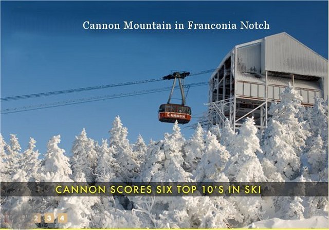
There are hundreds of other trails in the White Mountains of New Hampshire. An easy nearby trail is the Rim Trail on the top of Cannon Mountain. This is easy because a skiing tram takes you to the top of the mountain in the summer as well as in the winter. This is easy because it is also a short trail that begins at the restaurant on the top of Cannon Mountain. I like real bathrooms, restaurants, and bars. That's roughing it in my style.
This is the Cannon Mountain tram in ski season (about 10 miles from my house)
There are also a number of chair lifts
Cannon is known for its steep trails that intimidate novice skiers
Hometown boy Bode Miller says if you can ski Cannon you can ski anywhere
This is a tram photo that I took in August 2011 when daughter Maria and I went up to
hike the Cannon Mt. Rim Trail

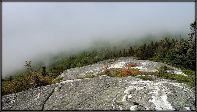
Here's part of the Omega Trail (straight up and down) that we did not climb on
Cannon Mountain
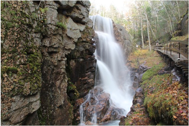
Another hike that is beautiful in Franconia Notch State Park is the Flume Gorge
about 15 miles from our cottage
This is longer than the Rim Trail but is made easy with lots and lots of wooden
steps
And there is fast-flowing water crashing on rocks along with water falls
http://nhstateparks.org/explore/state-parks/flume-gorge.aspx
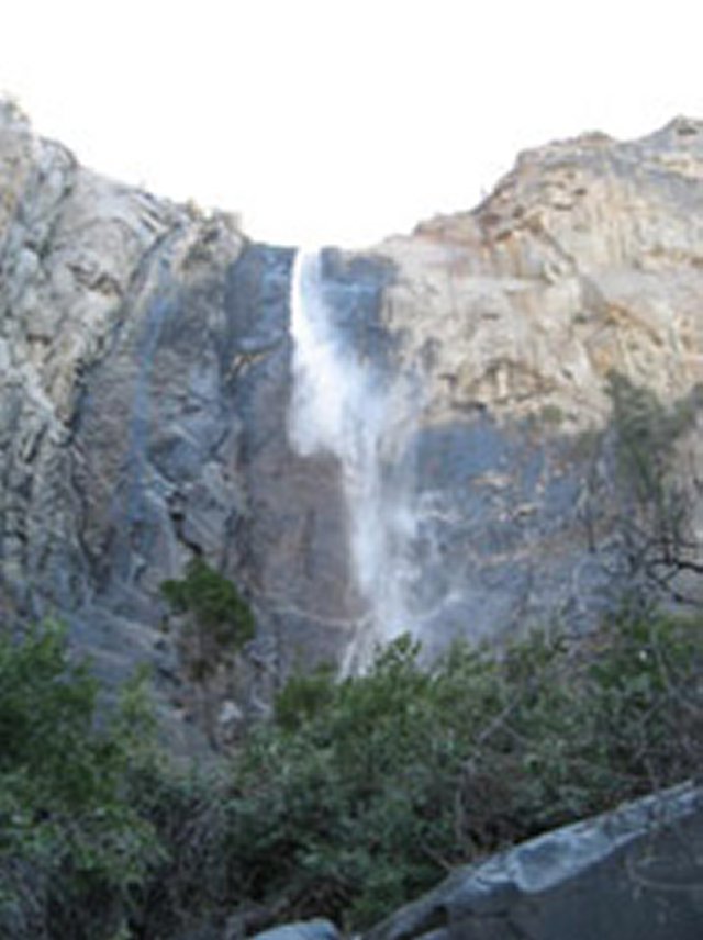
A longer and well known trail further from the main road is the Trail to Bridal
Falls
On the west side of Cannon Mountain (about 2.5 miles)
http://nhmountainhiking.com/bridal.html
Below are some pictures of nearby Bridal Falls along the trail

There are over 600 hiking trails in the White Mountains (in multiple mountain
ranges) to the east of our cottage
Blogs of White
Mountain Hikers (many great photographs) ---
http://www.blogger.com/profile/02242409292439585691
Mt. Success --- http://www.summitpost.org/mount-success/182039
Mount Success is a prominent and massive mountains in the rugged Mahoosuc Range that straddles the NH/ME border. The lower slopes are typical Mahoosuc boreal forest; dense spruce and fir intermixed with deciduous trees. There are two broad, open summits of glacier-scoured granite hemmed in with blueberries and dwarf evergreens. The northern summit (3565') is slightly higher than the southern (3364'), though the southern summit has better views.
Mount Success is the last NH summit encountered by north-bound hikers on the Appalachian Trail and the first of the real Mahoosuc summits. South of here, the range is composed of disorganized lumps and bumps. To the north, it becomes a more coherent range of rugged peaks. In a lot of ways, Success is the anchor mountain for the entire range.
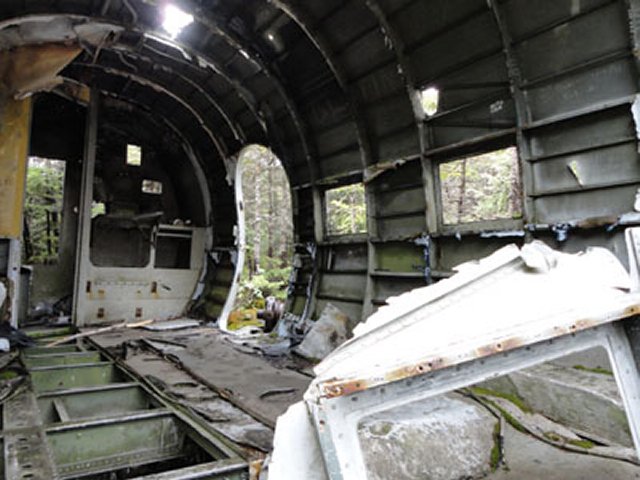
Among locals, Mount Success is also known as the site of an airplane crash in 1954.
Also see http://www.franklinsites.com/hikephotos/NewHampshire/mtsuccess.php
The Presidential Range is in the Background
For more wreckage photographs go to
http://scenicnh.com/blog/2009/09/b-18-bomber-crash-mt-waternomee/Also shown at the above link are pictures from another crash site on Mt. Waternomee in New Hampshire
John
Compton's Report About the Site and Wreckage of a Northeast Airlines DC 3
that
got caught up in a powerful downdraft near Mt. Success ---
http://1happyhiker.blogspot.com/2012/06/several-excellent-blogs-about-ww2.html
Once upon a time, there were regularly scheduled commercial flights between small cites in the U.S. Northeast Airlines Flight 792 used DC3 equipment to fly between Berlin, NH and Laconia, NH. On the day of the crash (on Mt. Success) , the plane was carrying four crew members and three passengers. All seven survived the crash, but while awaiting rescue two of the crew members died from their injuries. It wasn't until the morning of December 2nd that the survivors were spotted and rescued. A search of the Internet will yield reports containing more details of this crash. Click HERE for one such report.
Shown below is a composite of a few snapshots that I took during my visit to the crash site. But if you want to see some truly excellent photos taken by a real photographer, then you should visit the ScenicNh blog (Click HERE) where Erin Paul Donovan has posted his photos.


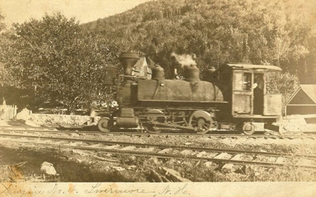
When the topic of ghost towns comes up, most Americans think of abandoned mining
towns in the western U.S.
But New England also has ghost towns, most of which are abandoned timbering
towns
One such ghost town on the Sawyer Pond Hiking Trail is Livermore, NH
It is now part of the White Mountains National Forest
http://en.wikipedia.org/wiki/Livermore,_New_Hampshire
Dr. Peter Crane wrote his doctoral dissertation on
Livermore.
It's the most comprehensive work on the subject. It may be hard to find but well
worth the effort.
http://whitemountainhistory.org/Livermore.html
Forrest Seavey's Audio Slide Show of Livermore
http://vimeo.com/7132826
This is well done by Forrest!
The Sawyer River Railroad ---
http://whitemountainhistory.org/Sawyer_River_Railroad.html

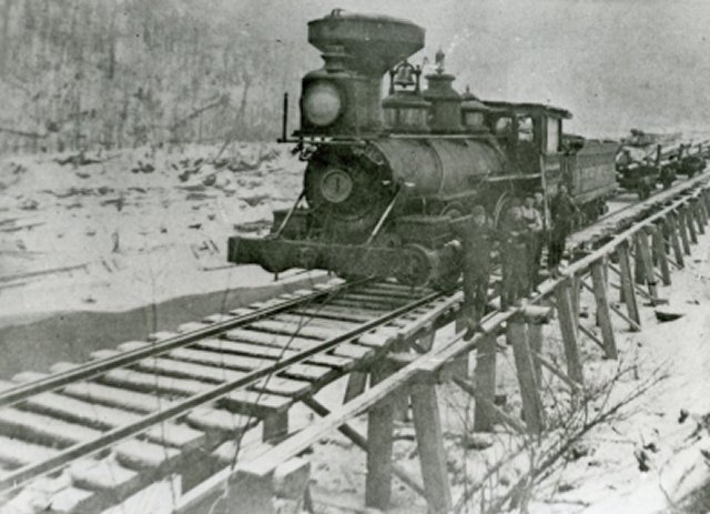

Other
Photos of the nearby Sawyer River Railroad
http://photos.whitemountainhistory.org/GalleryThumbnails.aspx?gallery=267707
More of Bob Jensen's Pictures and
Stories
http://www.trinity.edu/rjensen/Pictures.htm
WhiteMountainHistory.org ---
http://whitemountainhistory.org/
Over 70 Historical Photographs ---
http://photos.whitemountainhistory.org/AlbumHomeView.aspx
Blogs of White
Mountain Hikers (many great photographs) ---
http://www.blogger.com/profile/02242409292439585691
Especially note
the archive of John Compton's blogs at the bottom of the page at
http://1happyhiker.blogspot.com/
Question
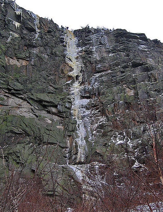
Are their trails in our White Mountains of New Hampshire that have ice in summer
as well as winter?
See "The Ice Gulch, Would I do it Again" by John Compton, August 5, 2011 ---
http://1happyhiker.blogspot.com/2011_08_05_archive.html
Okay, you might ask, is there really ice in the Ice Gulch, even in August? Yes, there is! The next photo shows one small patch of ice. There were many larger patches, but they were at the bottom of some of those deep gaps that I mentioned above. I took some photos, but none of them really turned out, even with using a flash to illuminate these dark, dank, deep spots.
AMC White Mountain Guide: Hiking Trails in the White Mountain National
Forest ---
http://books.google.com/books/about/AMC_White_Mountain_Guide.html?id=V6-hFq6yHcAC
Find Hiking Trails --- http://www.traillink.com/?gclid=CPPLy8-wt7ECFYNx4AodR2QAsQ
On May 14,
2006 I retired from
Trinity University after a long and
wonderful career as an accounting professor in four universities. I was
generously granted "Emeritus" status by the Trustees of Trinity University. My
wife and I now live in a cottage in the White Mountains of New Hampshire ---
http://www.trinity.edu/rjensen/NHcottage/NHcottage.htm
Bob
Jensen's Blogs ---
http://www.trinity.edu/rjensen/JensenBlogs.htm
Current and past editions of my newsletter called New
Bookmarks ---
http://www.trinity.edu/rjensen/bookurl.htm
Current and past editions of my newsletter called
Tidbits ---
http://www.trinity.edu/rjensen/TidbitsDirectory.htm
Current and past editions of my newsletter called
Fraud Updates ---
http://www.trinity.edu/rjensen/FraudUpdates.htm
Bob Jensen's past presentations and lectures
---
http://www.trinity.edu/rjensen/resume.htm#Presentations
Our
address is 190 Sunset Hill Road, Sugar Hill, New Hampshire
Our cottage was known as the Brayton Cottage in the early 1900s
Sunset Hill is a ridge overlooking with
New Hampshire's White Mountains to the East
and Vermont's
Green Mountains to the West
Bob Jensen's Threads --- http://www.trinity.edu/rjensen/threads.htm
Bob Jensen's Home Page --- http://www.trinity.edu/rjensen/