This north end lies between Mt. Washington and the south end opens up into Mt. Washington Valley
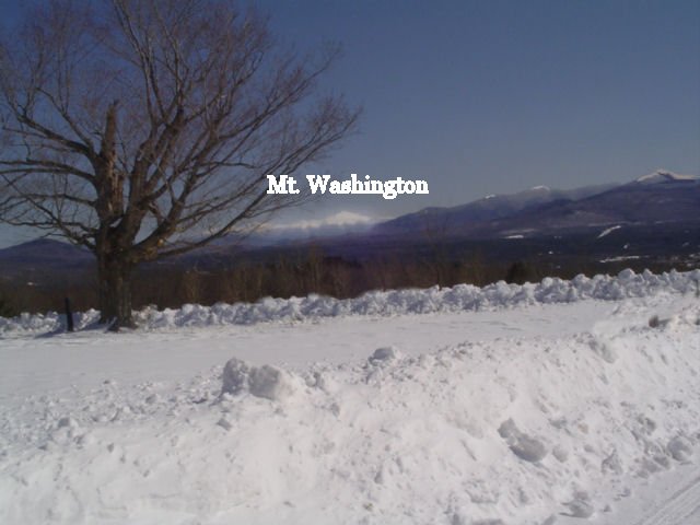
I can see Mt. Washington from my driveway and desk
History of the White Mountains --- Set 4 (Crawford Notch)
Bob Jensen at Trinity University
The north end
of Crawford Notch is about 30 miles from our cottage on Route 302
This north end lies between Mt. Washington and the south end opens up into Mt.
Washington Valley
I can see Mt. Washington from my driveway and desk
We will be
staying in the Attitash
Mountain Ski Resort Hotel next weekend
This resort is near the south end of Crawford Notch
The occasion is the 90th birthday of our close and still very vigorous friend
Helmut
Helmut and
Helene live in a chalet about five miles from our cottage
Helmut and Helene came to the USA following his four years of duty on a German
U-Boat
Near the end of WW II he was an engineer on the most advanced U-Boat in German
Navy
Their daughter Herta is a widow who
recently retired from her job in Boston
She's an avid skier in the winter and active hiker and kayaker the summer
Last autumn she moved from Boston to a home near the Mt. Attitash Ski Resort
In the wintertime her Bostonian son grooms trails at the Sunday River Ski Resort
in Maine
Whereas today we have a puny four
feet of snow in our yard Herta says she has over six feet in her forest home
She complains that after having her roof shoveled she cannot see outside from
any window
In the last edition of Tidbits I
featured Franconia Notch near our cottage
History of The White Mountains --- Set 03
(Franconia Notch)
http://www.trinity.edu/rjensen/Tidbits/Mountains/HistoryWhiteMountains/03/WhiteMountains03-FranconiaNotch.htm
Whereas Franconia Notch sits in the
middle of nowhere, Crawford Notch opens up into the Mt. Washington Valley to the
south
Mt. Washington Valley is one of the most populated regions in New Hampshire
Whereas you can almost always approach Franconia Notch at 70 mph on I-93,
the traffic south of Crawford Notch is almost always bumper-to-bumper on Route
302,
Whereas there are few people, few hotels, few restaurants, and almost no
shopping near Franconia Notch,
the south end of Crawford notch is filled with shopping centers and hotels and
restaurants catering to tourists and skiers
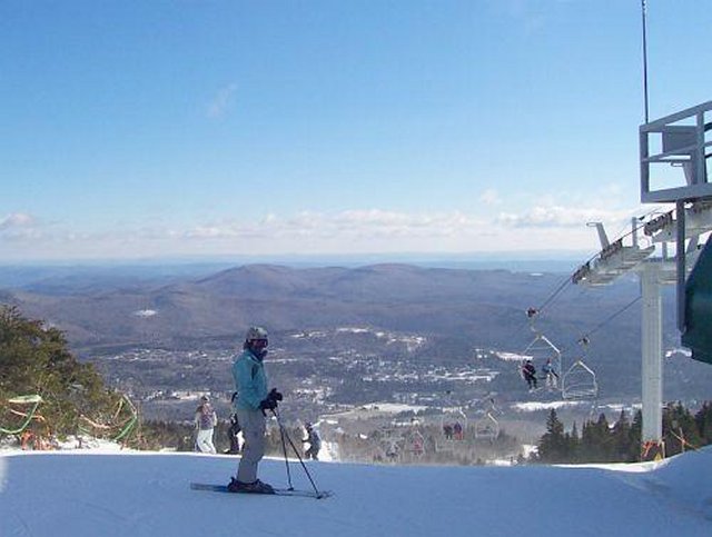
Whereas there are only two ski resorts in Franconia Notch (Cannon and Loon)
There are multiple ski resorts in or near Crawford Notch
Skiing in New Hampshire --- http://gonewengland.about.com/od/skinewhampshire/
The two notches are connected on the
north ends by Route 302 and on the south ends by the mountainous
Kancamagus Highway
One of the reasons the Mt. Washington Valley gets more tourists is that Route
302 takes a sharp turn east between Conway and North Conway
Form here it's only a little more than an hour to the Atlantic Ocean such that
tourists often want to visit both mountains and an ocean
Previously I have featured
photographs Mt. Washington at the north end of Crawford Notch ---
http://www.trinity.edu/rjensen/Tidbits/Mountains/HistoryWhiteMountains/01/HistoryWhiteMoutains01.htm
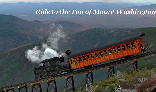
Also see the my pictures of the Cog Railroad
leading to the top of Mt. Washington
http://www.trinity.edu/rjensen/Tidbits/Mountains/HistoryWhiteMountains/01/HistoryWhiteMoutains01.htm

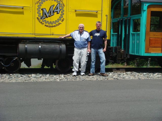
With my son Marshall
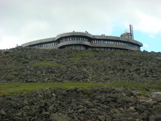
This is the tourist deck near the weather station at the summit of always-windy
Mt. Washington
I took this as we approached the summit on the cog railroad
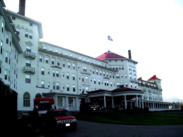
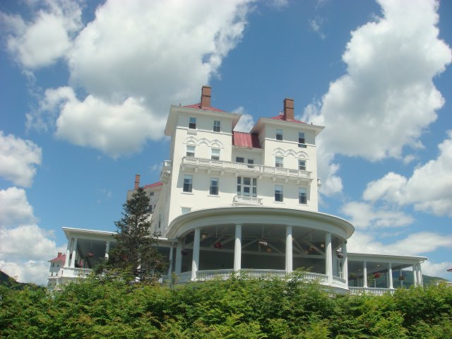
Down below is the famous
Mt. Washington Hotel (now an Omni Hotel) where Erika and I like to stay now
and then with friends

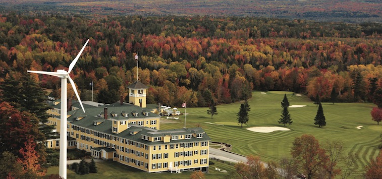
To the far north of Crawford Notch is the Mountain View Grand Hotel where we also sometimes stay with friends

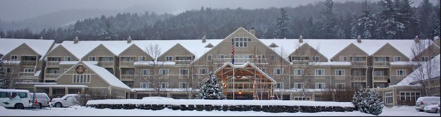
Near the south end of Crawford Notch is the
Attitash Grand Summit Hotel where we will be staying next weekend


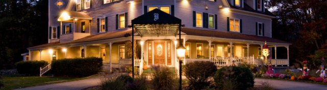
Erika and I have also stayed in the nearby
Bernerhof Inn
Where the heat left something to be desired
But you have to love the new owners starting out on an American Dream
Crawford Notch --- http://en.wikipedia.org/wiki/Crawford_Notch
Crawford Notch is the steep and narrow gorge of the Saco River in the White Mountains of New Hampshire, located almost entirely within the town of Hart's Location. Roughly half of that town is contained in Crawford Notch State Park.
The notch is at the upper or northern end of this gorge (constituting the extreme southern end of a panhandle at the southeastern corner of the town of Carroll), where the land descends both to north and south, and ascends both to east and west. However, the steepness of the south-flowing Saco's gorge (in contrast to the leisurely descent of the northward drainage into the watershed of Crawford Brook and eventually the Ammonoosuc River) makes it natural to attach the name to the gorge.
The gorge (like Hart's Location) is bisected by U.S. Highway 302 and the Saco, which run very similar courses.
History
The notch became known to European settlers when found by Timothy Nash in 1771. The 1772 boundaries of Hart's Grant reflected its shape. It was named for Abel Crawford, an explorer, trail-builder and hosteler in the early 19th century. The Tenth New Hampshire Turnpike from Portsmouth was extended through the notch to Lancaster in 1803. The turnpike and later Portland and Ogdensburg Railroad through Crawford Notch opened a new route through the White Mountains for settlers of the area to the northwest to reach Conway on the way to the trading ports on the coast.[1] Crawford Notch (1867), by Thomas Hill (1829–1908), looking north, collection of the New Hampshire Historical Society
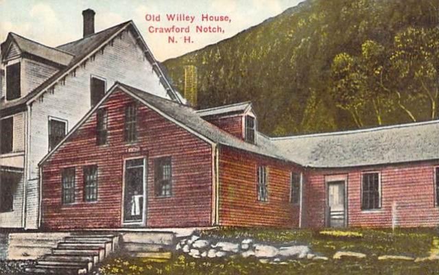
A well-documented historic event within the notch was a rock-slide that killed the entire Samuel Willey family in August, 1826. The family fled their home during the storm to a prepared shelter but were buried by the slide and died in a mass of stone and rubble. Their home was untouched. Mount Willey, on the west side of the notch, is named in their memory. Further down the notch, Nancy Brook and Mount Nancy are named for an earlier tragedy.
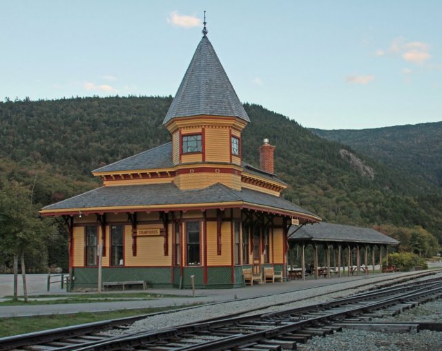
In the Carroll portion of the notch, the Appalachian Mountain Club has built and operates the Highland Center Lodge and Conference Center, and has renovated the Queen Anne style Victorian-era Crawford Notch Maine Central train depot as a bookstore. The depot remains a stop on the scenic "Notch Train" of the Conway Scenic Railroad, operated seasonally from North Conway.
Points of interest
- Grave of Samuel Bemis, first photographer of the American landscape
- Mount Willard, open summit near center of notch with outstanding views of the notch's structure
See Also
Franconia Notch and Crawford Notch are New
Hampshire State Parks
These are some pictures from the Crawford Notch State Park
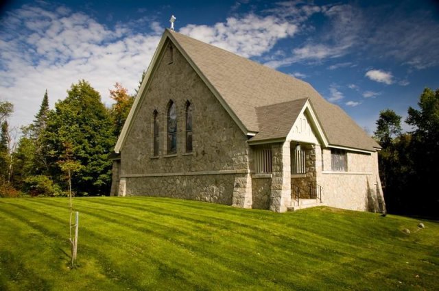
Stickney Chapel
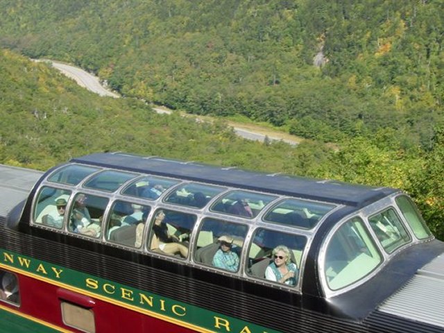
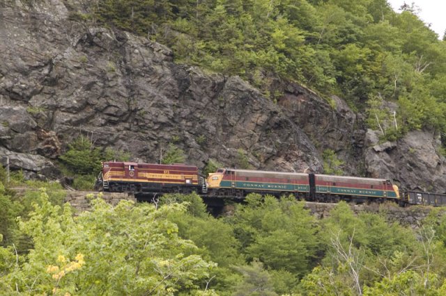
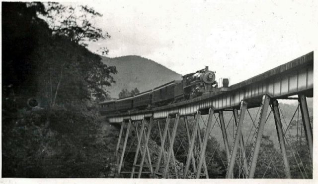
Here's a view of Route 302 and the passenger
railroad running above the highway

The railroad used for logging in the old days now
mostly carries tourists crossing the Notch

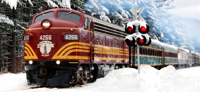
The Conway Scenic Railroad Station where tourists
board for a ride across the Notch
This is nothing like the clanking and jerking ride
on the Cog Railroad up Mt. Washington


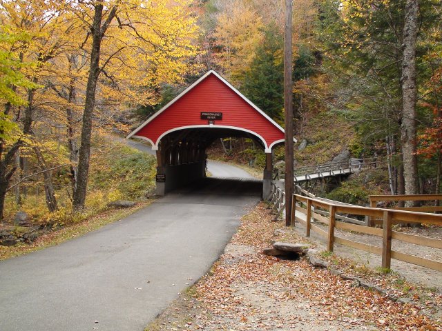
The covered bridge at Wikipe
Moose cow with calf in Crawford Notch


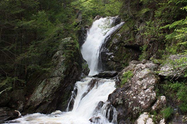
Silver Flume Cascades

Elephant Head in Crawford Notch

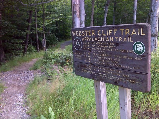
The Appalachian Trail can be accessed from both the Franconia and Crawford
Notches
The Appalachian Mountain Club even has a hotel near the north end of Crawford
Notch

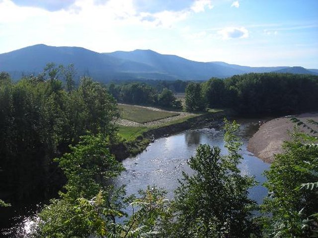
Saco River ---
http://en.wikipedia.org/wiki/Saco_River
The Saco River was extremely beneficial and extremely dangerous to settlers on
either end of Crawford Notch. Storms sometimes destroyed farms with floods and
avalanches.
The Saco River is a river in northeastern New Hampshire and southwestern Maine in the United States. It drains a rural area of 1,703 square miles (4,410 km2) of forests and farmlands west and southwest of Portland, emptying into the Atlantic Ocean at Saco Bay, 136 miles (219 km) from its source.[1] It supplies drinking water to roughly 250,000 people in thirty-five towns; and historically provided transportation and water power encouraging development of the cities of Biddeford and Saco and the towns of Fryeburg and Hiram.[2] The name "Saco" comes from the Eastern Abenaki word [sɑkohki], meaning "land where the river comes out"
The river rises at Saco Lake in Crawford Notch in the White Mountains and flows generally south-southeast through Bartlett and Conway in Carroll County, New Hampshire before crossing into Oxford County, Maine.
Shortly after entering Fryeburg, Maine, the river branches into the "Old Course" Saco River and the more commonly used "Canal River". Constructed in the 1800s to be more convenient for farmers, the 6-mile (10 km) long canal is 15 miles (24 km) shorter than the old course[4] and is now considered to be the official course for the river, as the upstream end of the old course is largely silted over. The two channels merge again near Lovell, Maine.
After running through six hydropower stations operated by NextEra Energy Resources (including Skelton Dam and Bonny Eagle Dam), the river enters York County, crosses under Interstate 95, and passes between Saco and Biddeford, where it is bridged by U.S. Route 1. It enters Saco Bay on the Atlantic with Camp Ellis in Saco on the north shore and Hills Beach in Biddeford on the south shore.
Continued in article
The Saco River running from Crawford Notch to the
Atlantic Ocean

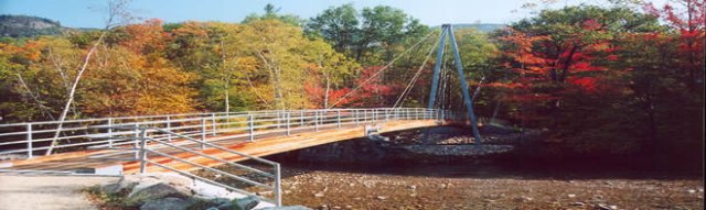
Bemis Bridge over the Saco River

Crawford Notch History from the New
Hampshire State Park Service (free)---
https://www.nhstateparks.org/uploads/pdf/WilleyHouse-InfoSheet.pdf
Discovery:
In 1771, a Lancaster hunter named Timothy Nash discovered what is now called Crawford Notch while tracking a moose over Cherry Mountain. He noticed a gap in the distant mountains to the south and realized it was probably the route through the mountains mentioned in Native American lore. Packed with provisions, he worked his way through the notch and on to Portsmouth to tell Governor John Wentworth of his discovery. Doubtful a road could be built through the mountains, the governor made him a deal. If Nash could get a horse through from Lancaster, he would grant him a large parcel of land at the head of the notch, with the condition that he build a road to it from the east. Nash and his friend Benjamin Sawyer managed to trek through the notch with a very mellow farm horse that, at times, had to be lowered over boulders with ropes. The deal with the governor was kept, and the road, at first not much more than a trail, was opened in 1775.Settlement:
The Crawford family, the first permanent settlers in the area, exerted such a great influence on the development of the notch that the Great Notch came to be called Crawford Notch. In 1790, Abel Crawford, his wife Hannah (Rosebrook), and their growing family settled on the land granted to Sawyer and Nash, at what is now Fabyans in Bretton Woods. Two years later, Hannah’s father Eleazer Rosebrook moved with his family to Abel’s homestead. In turn, Abel’s family settled 12 miles away at the head of the notch in Hart’s Location, for more “elbow room.” Both families operated inns for the growing number of travelers through the notch. Abel’s inn was the Mount Crawford House. Ethan Allen, Abel’s son, inherited the inn operated by the Rosebrooks. In addition to being established innkeepers, the Crawfords were famous mountain guides that escorted visitors to the top of Mt. Washington. In 1819, Abel and Ethan Allen opened the Crawford Path, the footpath they had blazed to the summit. By 1840, horses could be on the trail. In 1821, Ethan Allen blazed a shorter route up Mt. Washington that is closely followed today by the cog railway.Railroad:
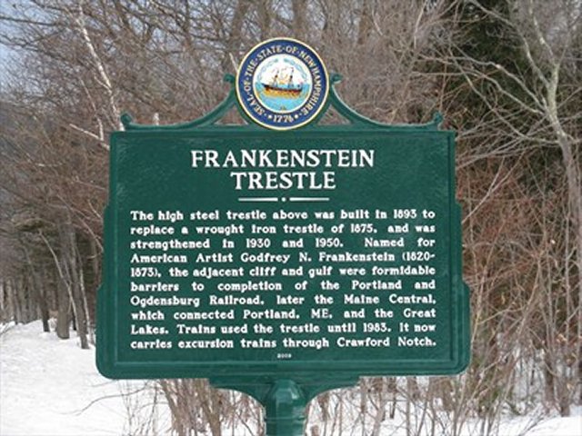
Increasing tourism to the White Mountains generated interest in the building of a railroad through Crawford Notch. The construction of the railroad was considered a difficult engineering feat that was thought to be impossible by many. The railroad, built by Anderson Brothers of Maine, was opened in 1875. It ran from Portland, through the notch, to Fabyans, the area where Ethan Allen had operated his inn. Great difficulties and expenses were encountered due to the gain of 1,623 feet in elevation in the 30 miles between North Conway and Fabyans. There is an average rise of 116 feet per mile for the nine miles between Bemis Station at the south end of the notch and Crawford Depot. Impressive Frankenstein Trestle, originally built of iron and later replaced by steel, is 80 feet high and 500 feet long. The Willey Brook Bridge is 100 feet high and 400 feet long.Crawford Notch State Park:
Most of the land in Crawford Notch was acquired by the state of New Hampshire in 1913. It was the result of a bill passed by the legislature in 1912 aimed at rescuing the northern region of Hart’s Location from excessive timber harvest. The bill failed to include the northern, most scenic part of the notch, which the state purchased in 1912 for $62,000. Almost 6,000 acres are included in the state park. The land extends on both sides of the highway to the summits of the mountains that border the Saco River Valley. In 1922, the Willey House clearing was leased to Donahue and Hamlin of Bartlett, who built a cabin colony of peeled spruce logs for vacationers. More log buildings were added including restrooms, a restaurant, and gift shop, but eventually the state took back the clearing for its own operations.
Historical Crawford Notch: A
Visitors Guide (free)--
by Nathan Pasquale & Rachelle Lyons
Plymouth State University
4/26/2011
http://www.plymouth.edu/center-for-rural-partnerships/files/2011/07/Crawford-Notch-Visitors-Guide-final.pdf
. . .
Sites to See
Mt. Washington -
The highest peak in New England, Mt Washington dominates the landscape. The original name given to the mountain by the Abenaki tribe was Agiocochook (Johnson ) . Today it can be vie wed all along Route 302 in t he n notch. This amazing mountain is rich in history, and can be accessed from the historic Crawford and Davis paths . On the clearest days you can see the Mt Washington Weather Observatory located at the very top of the peakBemis Bridge -
Located At the beginning of the Davis path, Bemis Bridge is the only Asymmetrical Cable - Stay Suspension Bridge in New England. This bridge crosses the Saco River with no piers to get in the way of spring runoff. The bridge is handicap accessible, and is open all year round.Frankenstein Trestle –
Constructed in 1875 for the Portland & Ogdensburg Railroad, this was an amazing feat of engineering. The trestle is nestled in the 2,555 ft. Frankenstein Cliffs. It is named after the painter Godfry Frankenstein , who had pain ted the cliffs 22 years earlier . Today the railway is use d by the Conway Scenic Railroad. It can be seen with a keen eye across the road from the Crawford Notch Campground.Appalachian Trail Crossing -
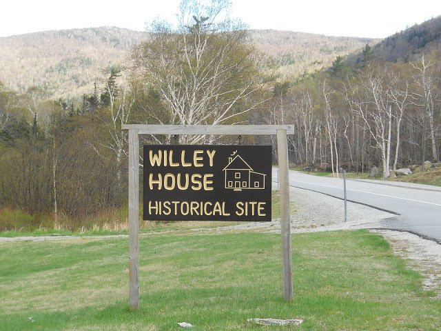
This humble trail crossing marks the National Scenic Appalachian Trail. Envisioned in 1921 by Benton MacKaye, a leader in the conservation efforts of the time, the trail was completed in 1937 (Johnson). It spans fourteen states and 2 , 160 miles from Springer Mt. in Georgia to the northern terminus at Mt. Katahdin in Maine. 160 miles of the trail are in NH.Willey Historic Site -
The familiar phrase, “It gives me the Willey’s,” was born out of the tragedy that took place here in 1826. The story of the Willey Slide is one of the more macabre tales of Crawford Notch history. Today the NH Division of Parks and Recreation maintains a rest stop commemorating the tragic land slide that took the lives of the entire Willey family.Silver and Flume Cascades -
Located on the west side of route 302 , with their falls and rushing water, the amazing Flume and Silver Cascades can only partially be appreciated from the road. These two cascades , located next to each other , are around 300 feet tall, and empty into the Saco River . These beautiful falls are easily seen from the parking areas close by and can be accessed by trails alongside them.Elephant Head -
This amazing rock formation looks as if a giant elephant is about to stroll out onto the road . Visible looking east down 302 from the Highland C enter the head will stand out among the trees. Elephant Head has been a focal point for many paintings of the notch (whitemountainart.com) . You can view it on a drive by, or take a short hike to the top of the elephant ’s head.Train Depot & Highland Center Gardens -
Just beyond Elephant Head is the Crawford Depot. This depot , built in 1891 , is featured in the National Register of Historic Places (whitemountainhistory.com) . This spot gives you a feel for what it would be like to arrive by train to this once remote area. Today the depot is an information center and a regular stop for the Conway Scenic Railroad. Located next to the AMC Highland Center , the depot offers views of a beautiful meadows cape that features a variety of the area’s native floral and habitat for fauna .Stickney Chapel
Located on the West side of the road, just before the Mt. Washington Hotel is the Stickney Chapel. This chapel is named after Joseph Stickney, the builder of the Mt. Washington Hotel. Joseph died suddenly just a year after the Hotel ’ s completion. His wife, Carolyn had this chapel built in his memory (whitemountainhistory.org) . Today this granite chapel is the Episcopal Church of Transfiguration. This chapel is worth the stop, with painted glass windows that portray some of the area’s most significant vistas, including Crawford Notch and Mt. Willard. Be sure to examine the exterior as well where you will find some unique carvings in the stone. Twin Mountain Gazebo - located to the West at the intersection of Route 3 and 302 at the top of a hill overlooking the intersection. This once bandstand, now visitor information center , is a great place to stop to gather information not only about Crawford Notch, but the surrounding towns of Bethlehem and Twin Mountain. In front of this information center is a war memorial commemorating NH Citizens who fought for our country. The famous Ethan Allen Crawford is listed among these men.Continued in article
List of New Hampshire state parks
List of notches in New Hampshire
Skiing in New Hampshire --- http://gonewengland.about.com/od/skinewhampshire/
Bob Jensen's Photographs of the White Mountains
Set 1 --- http://www.trinity.edu/rjensen/Tidbits/Mountains/Set01/MountainsSet01.htm
Set 2 --- http://www.trinity.edu/rjensen/Tidbits/Mountains/Set02/MountainsSet02.htm
This set includes White Mountain hiking trail photographsBob Jensen's Favorite Pictures of Mt. Lafayette 10 Miles Distant
http://www.trinity.edu/rjensen/tidbits/Mountains/Layfayette01/Lafayette01.htm
With nine pages quoted from Bill Bryson's traumatic climb up Mt. Lafayette
A Walk in the Woods by Bill Bryson (Anchor Books, 2007)History of The White Mountains --- Set 01
http://www.trinity.edu/rjensen/Tidbits/Mountains/HistoryWhiteMountains/01/HistoryWhiteMoutains01.htmHistory of The White Mountains --- Set 02
http://www.trinity.edu/rjensen/Tidbits/Mountains/HistoryWhiteMountains/02/HistoryWhiteMoutains02.htmHistory of The White Mountains --- Set 03 (Franconia Notch)
http://www.trinity.edu/rjensen/Tidbits/Mountains/HistoryWhiteMountains/03/WhiteMountains03-FranconiaNotch.htm
Bob Jensen's
photo set on White Mountain Hiking Trails ---
www.trinity.edu/rjensen/Tidbits/HikingTrails/Set01/HikingTrailsSet01.htm
More of Bob Jensen's Pictures and
Stories
http://www.trinity.edu/rjensen/Pictures.htm
Long Trail Photographs (the Green Mountains of Vermont)
http://cdi.uvm.edu/collections/getCollection.xql?title=Long Trail Photographs
Oldest Long Distance Hiking Trail in the United States
February 18, 2012 message from my good friend Barry Rice in Baltimore
In the last 28 months, The Baltimore Sun has published all three of my submissions in the Travel Section of the print edition. The most recent was last Sunday. You can see them using this link even if you don’t have a Facebook account:
http://www.facebook.com/media/set/?set=a.601699392632. .2130135.20102311&type=3&l= 6289998058
On May 14,
2006 I retired from
Trinity University after a long and
wonderful career as an accounting professor in four universities. I was
generously granted "Emeritus" status by the Trustees of Trinity University. My
wife and I now live in a cottage in the White Mountains of New Hampshire ---
http://www.trinity.edu/rjensen/NHcottage/NHcottage.htm
Bob
Jensen's Blogs ---
http://www.trinity.edu/rjensen/JensenBlogs.htm
Current and past editions of my newsletter called New
Bookmarks ---
http://www.trinity.edu/rjensen/bookurl.htm
Current and past editions of my newsletter called
Tidbits ---
http://www.trinity.edu/rjensen/TidbitsDirectory.htm
Current and past editions of my newsletter called
Fraud Updates ---
http://www.trinity.edu/rjensen/FraudUpdates.htm
Bob Jensen's past presentations and lectures
---
http://www.trinity.edu/rjensen/resume.htm#Presentations
Our
address is 190 Sunset Hill Road, Sugar Hill, New Hampshire
Our cottage was known as the Brayton Cottage in the early 1900s
Sunset Hill is a ridge overlooking with
New Hampshire's White Mountains to the East
and Vermont's
Green Mountains to the West
Bob Jensen's Threads --- http://www.trinity.edu/rjensen/threads.htm
Bob Jensen's Home Page --- http://www.trinity.edu/rjensen/