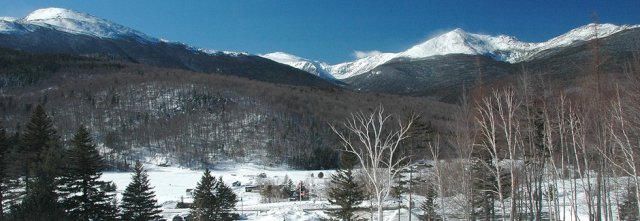
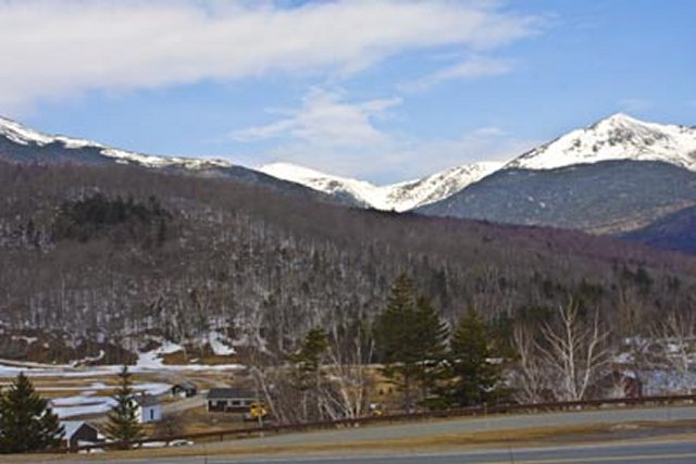
The Mt. Washington Hotel in the Presidential Range is on Highway 302
The auto road leading up to the summit of Mt. Washington starts near Gorham NH
Wildcat Mountain is near Jackson, NH
History of the White Mountains --- Set 5 (Pinkham Notch)
Bob Jensen at Trinity University
It has been a
cool May 2014 thus far with nights in the 40s and days in the 50s and 60s. Our
furnace funs every night, but
I have no complaints about the weather. At least there's no forecast of heavy
snow like we had last year at the end of May.
Our lawns and forests are lush with snow melt and great spring rains.
This week I
continue with my threads on the major notches among 37 notches New Hampshire
notches.
For some historic reason a mountain pass in New England is called a "notch."
This week I focus on the Pinkham Notch winding its way through the White Mountain National Forest
Pinkham Notch
is like a valley bordered on the western side by part of the
Presidential Mountain Range and
on the eastern side by five mountains in the
Wildcat Mountain Range
Pinkham Notch
---
http://pinkhamnotchnh.com/
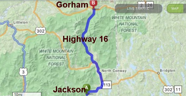
In the map
below Pinkham Notch is on Route 16 from Jackson to Gorham in New Hampshire
The Mt. Washington Hotel in the Presidential Range is on Highway 302
The auto road leading up to the summit of Mt. Washington starts near Gorham NH
Wildcat Mountain is near Jackson, NH
April 7, 2015 reply from Kaitlin
Hi Bob,
I am a student at Plymouth State University and I'm working on a project for a Remote Sensing class mapping alpine zones of the White Mountains and doing some statistical mapping comparisons. I came across your page about Pinkham Notch which really excited me, as I'm from Jackson and I really love the area, but I just wanted to point out that the map of Pinkham Notch is not quite accurate, Jackson is located about 5 miles North of the junction of 16 and 302 in Glen, currently the map shows that Jackson is located about 20 miles south in the Conway area. Your page has a great collection of pictures and info though, it looks like you're enjoying your time in the mountains! I love stories of people moving to the area from more urban places, especially when they love it here the way I do.
Take care,
Kaitlin
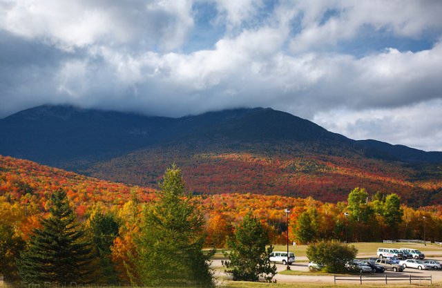
Wildcat Mountain
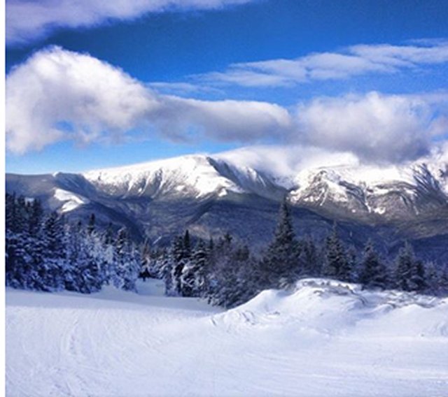
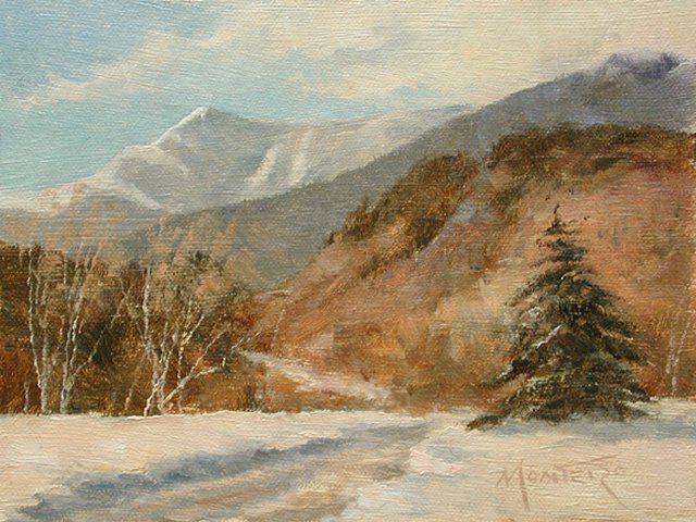
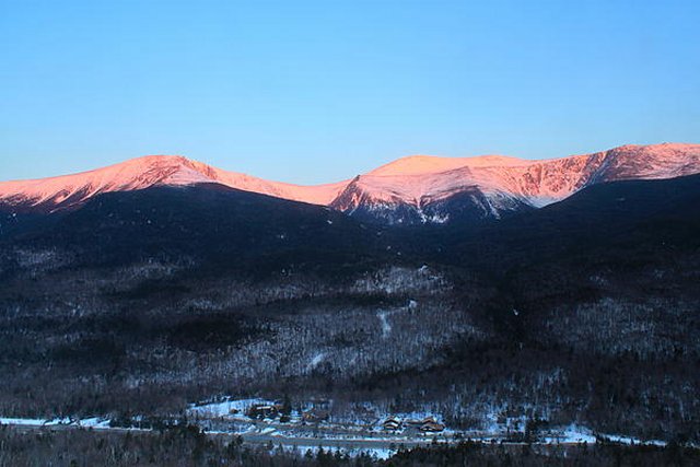
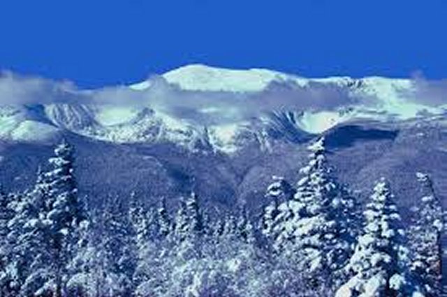
Mt. Washington Sunrise
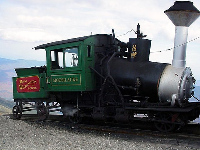
Historic steam locomotive of a logging train
Pinkham Notch --- http://en.wikipedia.org/wiki/Pinkham_Notch
Environment
2.1 Below 2500 ft. — Northern hardwood forest
2.2 2500 ft. to 4000 ft. — Spruce/fir forest
2.3 4000 ft. to timberline — Balsam fir forest
2.4 Above timberline — The alpine zone. . .
Geography
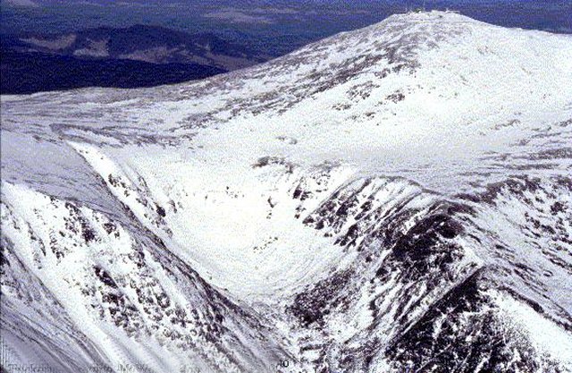
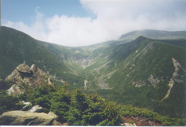
The notch separates the Presidential Range, which forms the western wall, from the Wildcat Range, which forms the eastern wall. Two rivers drain the notch; the Ellis River drains the south end and is a tributary of the Saco, and the Peabody River drains the north end and is a tributary of the Androscoggin.[1]The bulk of the western slope of the notch is formed by Mount Washington, the highest peak in the northeast United States, reaching 6,288 feet (1,917 m) above sea level.[2] Mount Washington rises more than 4,000 feet (1,200 m) above the floor of the notch.[1] A number of glacial cirques are found on this side of the notch. The Great Gulf and its tributary cirques form the largest cirque in the White Mountains.[3] South of the Great Gulf is Huntington Ravine, with a rocky, precipitous headwall renowned for its rock and ice climbing.[4] The slope then dips into the Ravine of Raymond Cataract, a non-glacial "V-shaped" valley with a notable waterfall.[3] After this comes Tuckerman Ravine, with a uniform, smoother headwall that is known for its high-quality skiing.[5] After passing the Gulf of Slides, a smaller and lesser-known cirque,[3] the notch opens up and continues until Jackson.
The eastern slope of the notch consists of the Wildcat and Carter-Moriah Ranges, slightly lower than the Presidential Range to the west. The Wildcat Range consists of five peaks, named A, B, C, D, and E from northeast to southwest in order of height.[6] Wildcat A is the highest, at 4,422 feet (1,348 m).[1] From the main ridge, the slopes drop very steeply, but not precipitously, to the floor of the notch. The Wildcat Mountain Ski Area occupies the western slopes of Wildcat up to the col between D and E peaks.[7] As the notch rounds E peak, the slope becomes extremely steep, and Wildcat Ridge begins to drop to the end of the notch.
The Carter-Moriah Range lies to the north of Wildcat Ridge, forming the eastern side of Pinkham Notch all the way to the Androscoggin River.[8] From south to north, the peaks overlooking the notch are Carter Dome (4,832 ft / 1,473 m), Mount Hight (4,675 ft / 1,425 m), South Carter Mountain (4,420 ft / 1,347 m), Middle Carter Mountain (4,600 ft / 1,402 m), North Carter Mountain (4,530 ft / 1,381 m), Imp Mountain (3,720 ft / 1,134 m), and Mount Moriah (4,049 ft / 1,234 m)
History
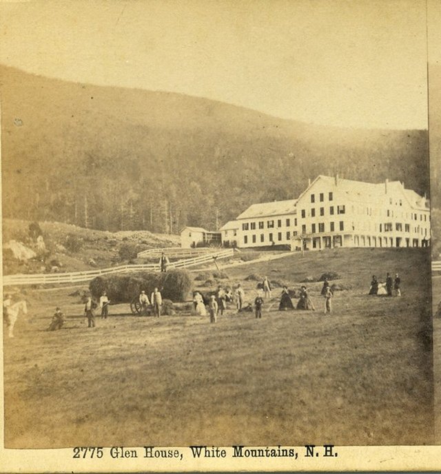
Pinkham Notch was originally a riverine, "V-shaped" valley until the Laurentide Ice Sheet shaped it into its current form, a "U-shaped" valley.[21] This shaping occurred during the Wisconsinian Ice Age, 25–50,000 years ago.[22] The geology of the region became greatly altered by this event; much of the weaker rock was stripped from the region, leaving only highly-resistant mica schist.[21] As the glaciers retreated, a layer of glacial till was deposited, including several glacial erratics.[23] A notable glacial erratic in the area is Mount Washington's Glen Boulder.[24] Artist Samuel Lancaster Gerry's 1877 depiction of Pinkham Notch, entitled "Tuckerman Ravine and Lion's Head".The notch first appears in recorded history in 1784, when an expedition led by Jeremy Belknap camped in the notch before ascending to the summit of Mount Washington through Huntington Ravine.[25] Pinkham Notch was far more isolated than neighboring Crawford Notch; as a result, the first settler of Pinkham Notch came in 1827, 43 years after habitation of Crawford Notch.[26] The first settler, Hayes Copp, built a homestead in the then-uninhabited area, near where the Dolly Copp campground stands today.[26] Copp and his wife lived alone in the wilderness until Daniel Pinkham completed the first road through the notch between in 1836, finally providing a link between the Copp homestead and civilization.[26] In 1851, a railroad was built to Gorham, and a hotel, the Glen House, was constructed to accommodate passengers.[27] Mount Washington was the main attraction in the area; a bridle path was constructed from the Glen House to hotels on the summit, which was later improved into what would become the Mount Washington Auto Road. Completion of the road in 1861 led to a massive increase in tourism.[28]
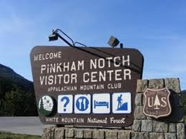
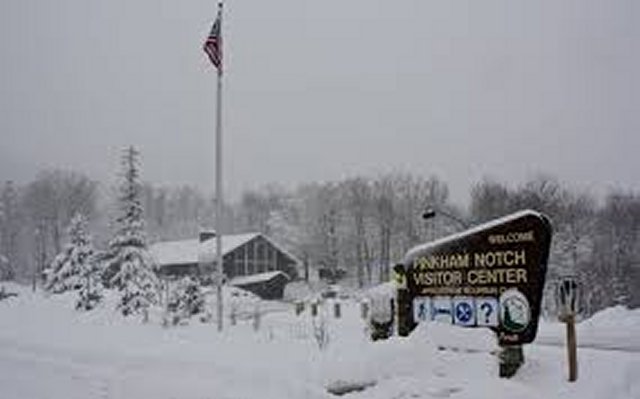
Meanwhile, logging began in the Pinkham area. After almost total deforestation of the White Mountain region, the White Mountain National Forest was created in 1911, and the Mount Washington area was added to the national forest in 1914.[29] With the preservation of the area, emphasis shifted from logging to recreation. The Appalachian Mountain Club converted a logging camp near the height-of-land into what is now the Pinkham Notch Visitor Center in 1921.[30] The Appalachian Trail was built through the visitor center, making it an important trailhead for ascents of Mount Washington. Meanwhile, ski trails began to be constructed by the Civilian Conservation Corps on Wildcat Mountain, and the ski resort was opened in 1958.[7]
In 1851, a railroad was built to Gorham, and a hotel, the Glen House, was constructed to accommodate passengers.[27] Mount Washington was the main attraction in the area; a bridle path was constructed from the Glen House to hotels on the summit, which was later improved into what would become the Mount Washington Auto Road. Completion of the road in 1861 led to a massive increase in tourism.[
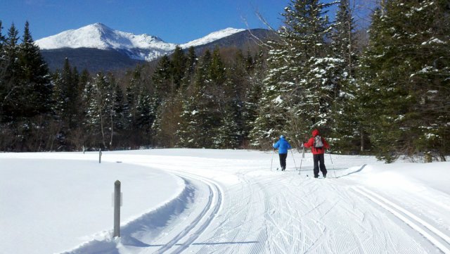
Recreation
Pinkham Notch is easily accessible by New Hampshire Route 16. Numerous opportunities for recreation exist in the area.Continued in article
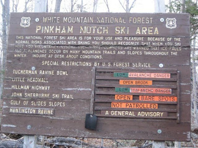
Tuckerman Ravine
The bowl of Tuckerman Ravine is famous for its extremely steep backcountry
skiing ---
http://en.wikipedia.org/wiki/Tuckerman_Ravine
Great Glen Trails --- http://greatglentrails.com/
http://www.copleysociety.org/exhibitions/view/3099/coso_artists_az_shiver.html
Pinkham Notch Visitors Center ---
http://www.outdoors.org/lodging/lodges/pinkham/pinkham-notch-visitor-center.cfm
Grand Trunk Railway --- http://en.wikipedia.org/wiki/Grand_Trunk_Railway
The Grand Trunk Railway was a railway system that operated in the Canadian provinces of Quebec and Ontario, and in the American states of Connecticut, Maine, Michigan, Massachusetts, New Hampshire, and Vermont.[1] The railway was operated from headquarters in Montreal, Quebec; however, corporate headquarters were in London, England (4 Warwick House Street). The Grand Trunk, its subsidiaries, and the Canadian Government Railways, were precursors of today's Canadian National Railways.
GTR's main line ran from Portland, Maine, to Montreal, and then from Montreal to Sarnia, Ontario, where it joined its western subsidiary.
The GTR had three important subsidiaries during its lifetime:
- Central Vermont Railway which operated in Quebec, Vermont, Massachusetts, and Connecticut.
- Grand Trunk Pacific Railway which operated in Manitoba, Saskatchewan, Alberta, and British Columbia.
- Grand Trunk Western Railway which operated in Michigan, Indiana, and Illinois.
St. Lawrence and Atlantic Railroad --- http://en.wikipedia.org/wiki/St._Lawrence_and_Atlantic_Railroad
The St. Lawrence and Atlantic Railroad (reporting mark SLR), known as St-Laurent et Atlantique Quebec (reporting mark SLQ) in Canada, is a short line railway operating between Portland, Maine on the Atlantic Ocean and Montreal, Quebec on the St. Lawrence River. It crosses the Canada-U.S. border at Norton, Vermont, and is owned by short line operator Genesee and Wyoming.
The line was built by the Atlantic and St. Lawrence Railroad in the U.S. and the St. Lawrence and Atlantic Railway in Canada, meeting at Island Pond, Vermont south of the Canada–United States border. Major communities served include Portland and Lewiston in Maine; Berlin, New Hampshire; Island Pond, Vermont; and Sherbrooke and Montreal in Quebec.
. . .
Milepost 91.6: Gorham 12 stall roundhouse and coaling tower until 1956 with shops from 1869 to 1902 Station built in 1907 housed the Gorham Historical Society when railroad occupancy ended.[
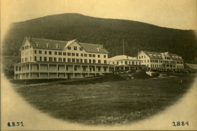
The first Glen
House hotel after the farm house was expanded
The second
Glen House Resort
The Glen House
Resort in its final1893 Days of Glory on the Grand Truck Railway
That was leased from the St. Lawrence and Atlantic Railroad

History of the Glen House --- http://whitemountainhistory.org/Glen_House.html
There have been four hotels known as the Glen House; the last one burned in 1967.
In 1851, the Grand Trunk Railway was completed from Portland, Maine to Gorham, NH. Tourist traffic increased dramatically.
In 1851, John Bellows began to re-model a farmhouse into a hotel on the site of what would become the Glen House. Although his building was not completed, he did take in some tourists that season. In April, 1852 Bellows sold the building to J. M. Thompson who changed the name to Glen House and continued to build. He had twenty or thirty rooms ready for that season and by 1853 had completed work. In the 1865-66 season Thompson expanded the hotel.
. . .
Just at the end of the 1884 season, the hotel was completely destroyed by fire. It was rebuilt, on a much grander scale, and partially re-opened for the 1885 season. Work continued and the new building was completed in 1887.
It was to have a short life, again being completely destroyed by fire in 1893. It was not rebuilt.
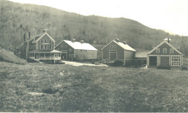
However, the property was sold to the Libby family of Gorham. They remodeled the building that had been the help's quarters prior to the fire, and re-opened it as a small 40 room hotel. This building was also eventually destroyed by fire.
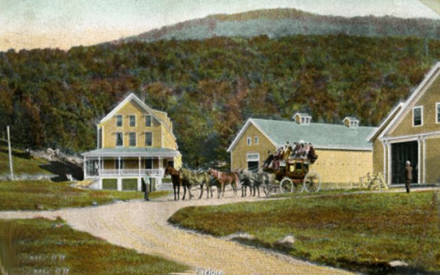
The third Glen
House Postcard after two disastrous fires
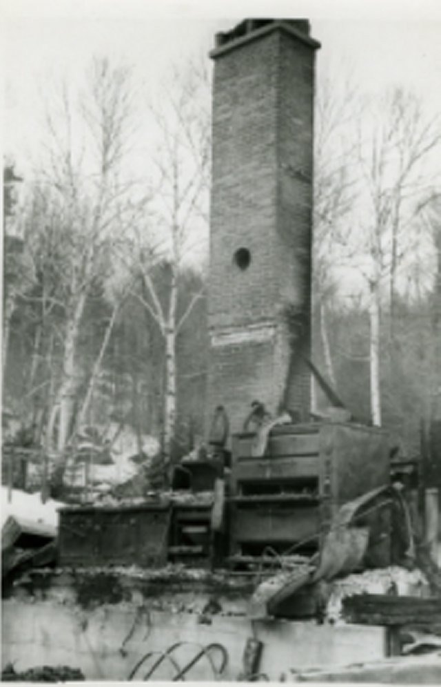
The fourth Glen House
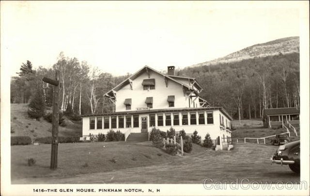
Ruins of the fourth Glen House in
1967
Bob Jensen's Photographs of the White Mountains
Set 1 --- http://www.trinity.edu/rjensen/Tidbits/Mountains/Set01/MountainsSet01.htm
Set 2 --- http://www.trinity.edu/rjensen/Tidbits/Mountains/Set02/MountainsSet02.htm
This set includes White Mountain hiking trail photographsBob Jensen's Favorite Pictures of Mt. Lafayette 10 Miles Distant
http://www.trinity.edu/rjensen/tidbits/Mountains/Layfayette01/Lafayette01.htm
With nine pages quoted from Bill Bryson's traumatic climb up Mt. Lafayette
A Walk in the Woods by Bill Bryson (Anchor Books, 2007)History of The White Mountains --- Set 01
http://www.trinity.edu/rjensen/Tidbits/Mountains/HistoryWhiteMountains/01/HistoryWhiteMoutains01.htmHistory of The White Mountains --- Set 02
http://www.trinity.edu/rjensen/Tidbits/Mountains/HistoryWhiteMountains/02/HistoryWhiteMoutains02.htmHistory of The White Mountains --- Set 03 (Franconia Notch)
http://www.trinity.edu/rjensen/Tidbits/Mountains/HistoryWhiteMountains/03/WhiteMountains03-FranconiaNotch.htm
History of The White Mountains --- Set 04 (Crawford Notch)
http://www.trinity.edu/rjensen/Tidbits/Mountains/HistoryWhiteMountains/04/WhiteMountains04-CrawfordNotch.htmHistory of The White Mountains --- Set 05 (Pinkham Notch)
http://www.trinity.edu/rjensen/Tidbits/Mountains/HistoryWhiteMountains/05/WhiteMountains05-PinkhamNotch.htm
More of Bob Jensen's Pictures and
Stories
http://www.trinity.edu/rjensen/Pictures.htm
List of the 25 Notches in New Hampshire's White Mountains ---
http://en.wikipedia.org/wiki/List_of_notches_in_New_Hampshire
Plus 12 notches in other New Hampshire Mountains
See Also
List of New Hampshire state parks
List of notches in New Hampshire
Skiing in New Hampshire --- http://gonewengland.about.com/od/skinewhampshire/
Bob Jensen's
photo set on White Mountain Hiking Trails ---
www.trinity.edu/rjensen/Tidbits/HikingTrails/Set01/HikingTrailsSet01.htm
Long Trail Photographs (the Green Mountains of Vermont)
http://cdi.uvm.edu/collections/getCollection.xql?title=Long Trail Photographs
Oldest Long Distance Hiking Trail in the United States
February 18, 2012 message from my good friend Barry Rice in Baltimore
In the last 28 months, The Baltimore Sun has published all three of my submissions in the Travel Section of the print edition. The most recent was last Sunday. You can see them using this link even if you don’t have a Facebook account:
http://www.facebook.com/media/set/?set=a.601699392632. .2130135.20102311&type=3&l= 6289998058
On May 14,
2006 I retired from
Trinity University after a long and
wonderful career as an accounting professor in four universities. I was
generously granted "Emeritus" status by the Trustees of Trinity University. My
wife and I now live in a cottage in the White Mountains of New Hampshire ---
http://www.trinity.edu/rjensen/NHcottage/NHcottage.htm
Bob
Jensen's Blogs ---
http://www.trinity.edu/rjensen/JensenBlogs.htm
Current and past editions of my newsletter called New
Bookmarks ---
http://www.trinity.edu/rjensen/bookurl.htm
Current and past editions of my newsletter called
Tidbits ---
http://www.trinity.edu/rjensen/TidbitsDirectory.htm
Current and past editions of my newsletter called
Fraud Updates ---
http://www.trinity.edu/rjensen/FraudUpdates.htm
Bob Jensen's past presentations and lectures
---
http://www.trinity.edu/rjensen/resume.htm#Presentations
Our
address is 190 Sunset Hill Road, Sugar Hill, New Hampshire
Our cottage was known as the Brayton Cottage in the early 1900s
Sunset Hill is a ridge overlooking with
New Hampshire's White Mountains to the East
and Vermont's
Green Mountains to the West
Bob Jensen's Threads --- http://www.trinity.edu/rjensen/threads.htm
Bob Jensen's Home Page --- http://www.trinity.edu/rjensen/